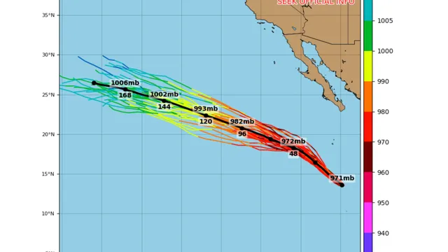
On July 27, 2026, Hurricane Genevieve reached Category 5 status while located approximately 700 miles southwest of Mexico. The storm exhibited maximum sustained winds of around 130-135 knots (150-155 mph) and a minimum central pressure of 934 millibars. Meteorologists noted that the rapid intensification of Genevieve occurred within a short time frame, as it escalated from a Category 1 hurricane to a major hurricane in less than a day. The National Hurricane Center (NHC) first classified Genevieve as a hurricane on July 25, 2026, when its winds reached 80 mph.
Favorable atmospheric conditions, including warm ocean waters and low wind shear, contributed to the storm's rapid development. The compact nature of Genevieve's circulation, with a radius of maximum winds of just 10 nautical miles, allowed for quick fluctuations in intensity. Despite its strength, the storm is not currently forecast to make landfall, although it is expected to generate dangerous surf and rip currents along the Mexican coast.
Forecasters predict that Genevieve may strengthen slightly more before beginning a gradual weakening trend later in the week. As it moves over cooler sea-surface temperatures and into a less favorable atmospheric environment, the storm is still expected to remain powerful for several days. The NHC has indicated that Genevieve is one of several significant tropical cyclones developing in the eastern Pacific this season, highlighting the ongoing activity in this region.
The situation remains closely monitored by meteorologists, as the storm's trajectory continues to track west-northwest over open waters. The potential for life-threatening conditions due to the storm's swells emphasizes the importance of public awareness and preparedness in coastal areas.