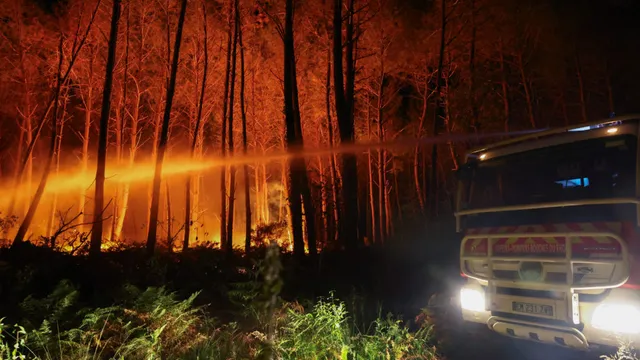
In July 2026, France and Spain experienced unprecedented wildfires that led to the evacuation of over 300,000 people. The fires were fueled by extreme heat and low rainfall, conditions exacerbated by climate change. In France, the Interior Ministry reported that 13,566 fires had burned over 116,000 hectares, marking the highest annual figure in modern records. Meanwhile, Spain faced its largest and third-largest fires ever, with significant blazes in the rural terrain of Ávila, which burned over 50,000 hectares. The situation was dire, with 13 fatalities reported in a fire in southeastern Almeria, highlighting the human cost of these environmental disasters.
The wildfires were part of a broader trend of increasing temperatures and drought conditions across Europe, which has seen multiple extreme heat events this year. A study by World Weather Attribution indicated that the record-breaking heat experienced in recent weeks would not have been possible without the influence of climate change. This year, the combination of prolonged heatwaves and low rainfall has created ideal conditions for wildfires, turning large areas of wilderness into tinderboxes.
In France, the Gironde region was particularly hard hit, with over 250,000 people evacuated. In Spain, 79,000 people were forced to leave their homes, particularly in villages west of Madrid and in Castellón. The European Union's Copernicus satellite program has been instrumental in providing emergency authorities with real-time maps of fire risk, aiding in evacuation and firefighting efforts.
As the situation continues to evolve, rising temperatures later in the week are expected to complicate firefighting efforts. The scale of the evacuations and the extent of the fires represent one of the largest emergency responses in Europe since World War II, underscoring the urgent need for effective climate action and disaster preparedness in the face of increasingly severe weather events.